|
Offered by Steve Hasz, Roatan Life Real Estate
|
 |
 |
 |
|
|
| |
 |
 |
|
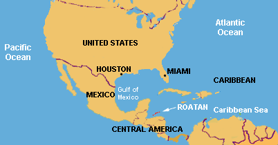
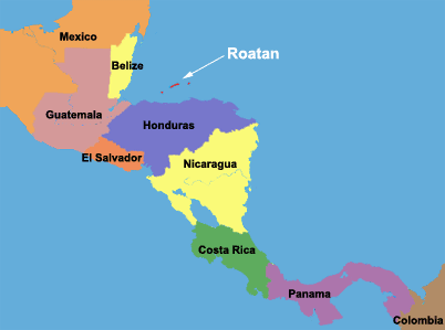
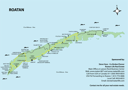
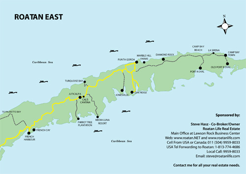
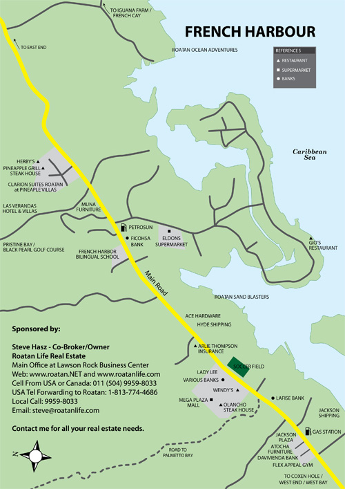
Maps of Roatan Island in the Western Caribbean AreaRoatan is located roughly 35 miles off the North Coast of Honduras in the Western Caribbean. The maps below show Roatan’s relationship to the United States and the Caribbean, its place in Central America, and the locations of its villages and towns. North American Map
Central America Map
Roatan Map
Roatan East Map
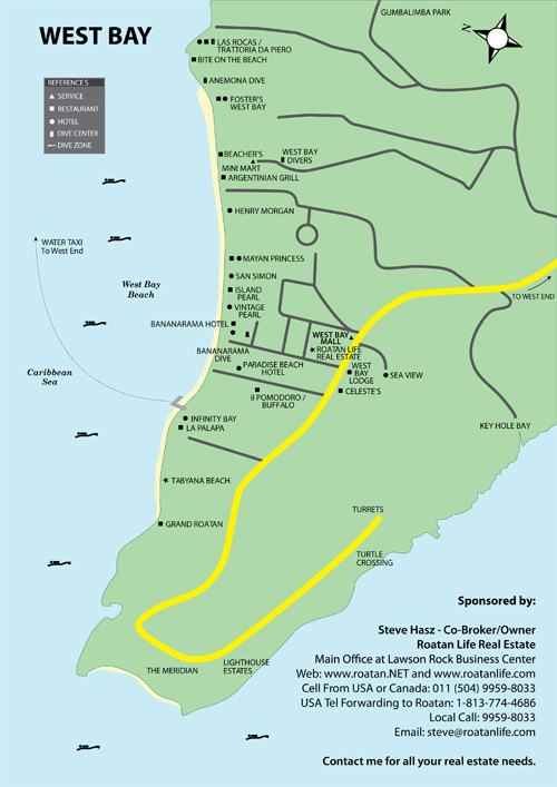
West Bay Map
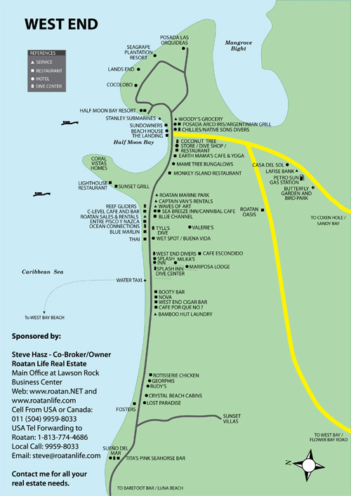
West End Map
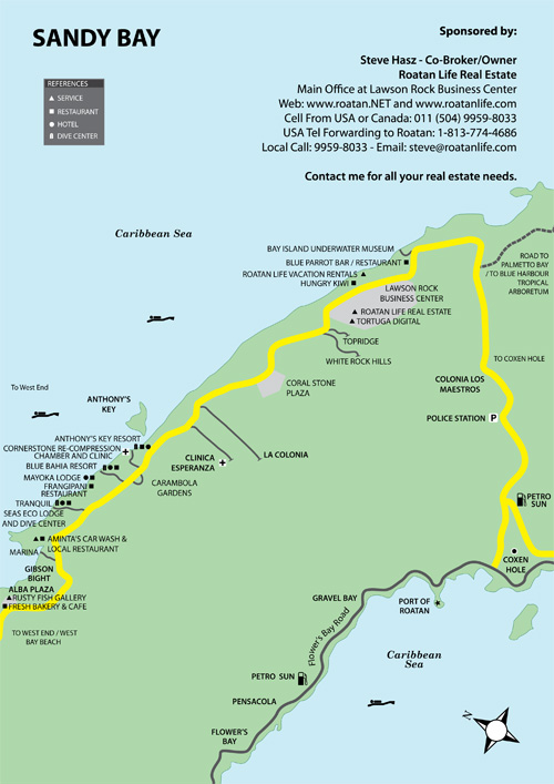
Sandy Bay Map
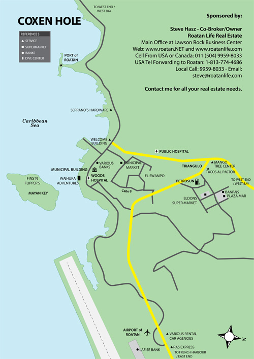
Coxen Hole Map
French Harbour Map
|
|